Llega a tu destino pasando por las mejores paradas del camino.

Camina, pedalea o conduce pasando por los parques, lugares de interés y sitios para comer mejor valorados. Gratis y sin registro.

Di adónde vas y elige parques, lugares de interés o comida. Recibes una ruta a pie, en bici o en coche que pasa por los sitios mejor valorados del camino, con el tiempo para tu trayecto y lista para abrir en Google Maps. Gratis y sin registro.

Planea tu viaje

Empieza con un toque o escribe dos lugares.

Buen momento

14:00 · 15°C · seco

o elige tu viaje

¿Qué estilo buscas?
¿Cómo vas a ir?
Mis paradas y filtros
Detour tolerance
Tipos de lugares incluidos
Guardado en este dispositivo para tus próximas rutas.
  1. Salida · Covent Garden
  2. Parada 1 · Somerset House
  3. Parada 2 · St Paul's Cathedral
  4. Parada 3 · The Monument
  5. Llegada · Tower of London

Todas las paradas tienen 4,5★ o más, además de la probabilidad de lluvia y la mejor hora para salir. Prueba esta ruta →

Dublín, Irlanda

Walking route · 3 stops

Georgian Dublin and the old city: a walk from Henrietta Street to St Stephen's Green

✓ Walked by Alberto before publishing · route facts measured

This route follows the worked example in our hidden gems guide: instead of the busy, direct line down O'Connell Street, it keeps the same direction but swaps the main roads for some of the city's most interesting streets. It starts on Henrietta Street, one of Dublin's earliest Georgian streets, and finishes at St Stephen's Green.

At a glance

Crowds
Medium
Footwear
Trainers

* Alberto's rating from doing the route.

88 en Maps Abrir en Mapas Personalizar Google Maps

Loading the route…

Measured route facts

Distance
2.6 km
Climb
15 m up · 15 m down
Away from traffic
39% of the way
Buggy & wheelchair
Step-free, paved
Benches on the way
54
Public toilets nearby
2
Playgrounds nearby
1
Drinking water
1
Perfil de elevación Descargar GPX
Perfil de elevación Elevation profile: from 16 m to 17 m, highest point 22 m, 15 m of climbing over 2.6 km 25 m5 m 0 m1.3 km2.6 km

Measured by Joyride AI from OpenStreetMap data on (benches within about 30 m of the route; toilets and playgrounds within about 80 m; elevation from Open-Meteo). Map data © OpenStreetMap contributors.

The route, stop by stop

  1. Start 0 m · 16 m elev
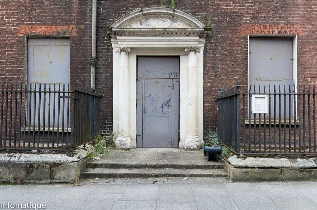
    Start: Henrietta Street
    Henrietta Street Area Dublin
    Henrietta Street · William Murphy
  2. Stop 1 640 m · 11 m elev
    Stop 1: Capel Street
    A long street of independent shops, cafés and restaurants, and a quieter alternative to O'Connell Street.
    Capel Street, Dublin
    Capel Street · Eric Jones
  3. Stop 2 1.3 km · 13 m elev
    Stop 2: Grattan Bridge
    Cross the Liffey here and look both ways along the river for one of the best views of the quays.
    Grattan or Cable Street Bridge, Dublin, Ireland
    Grattan Bridge · Christine Matthews
  4. Stop 3 1.9 km · 17 m elev
    Stop 3: Dublin Castle
    The castle yards are usually open to walk through. Check the official site for opening times and tours.
    Dublin Dublin Castle
    Dublin Castle · Jowaria
  5. Finish 2.6 km · 17 m elev
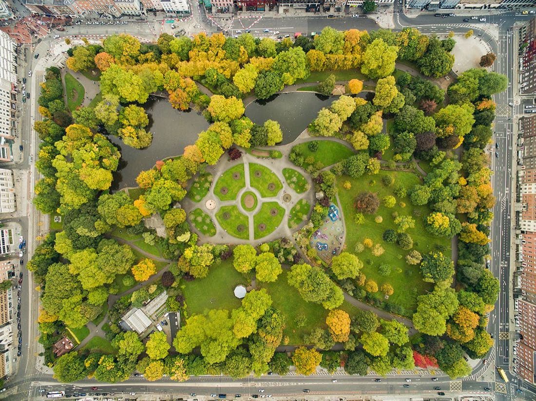
    Finish: St Stephen's Green
    Dublin Stephen's Green 44 edit
    St Stephen's Green · Dronepicr (edited by King of Hearts ) Edit corrects CA and sharpens image

Tips

  • Allow extra time at Dublin Castle if you want to look around the yards or join a tour.
  • Capel Street is lively at lunchtime and quieter in the morning, which suits photos.
  • Prefer a shorter walk? Finish at Dublin Castle and take the Luas or a bus from Dame Street.

Referencia y herramientas:

Georgian Dublin and the old city: a walk from Henrietta Street to St Stephen's Green · FAQ

How long is the Georgian Dublin and the old city: a walk from Henrietta Street to St Stephen's Green and what are the main stops?

Georgian Dublin and the old city: a walk from Henrietta Street to St Stephen's Green covers about 2.6 km (15 m climb) in Dublin with 5 stops in order: Henrietta Street → Capel Street → Grattan Bridge → Dublin Castle → St Stephen's Green.

Can I open Georgian Dublin and the old city: a walk from Henrietta Street to St Stephen's Green in Joyride AI Maps or download a GPX file?

Yes — tap "Open in Maps now" to load all 5 stops into Joyride AI Maps with live turn-by-turn navigation, or download the verified GPX track (route-georgian-dublin-walk.gpx) for Garmin, Komoot, Strava or Apple Watch.

Times and distances come from Google Maps and depend on the exact path you take. Always check opening hours and local conditions before you go. More ready-made routes.