Llega a tu destino pasando por las mejores paradas del camino.

Camina, pedalea o conduce pasando por los parques, lugares de interés y sitios para comer mejor valorados. Gratis y sin registro.

Di adónde vas y elige parques, lugares de interés o comida. Recibes una ruta a pie, en bici o en coche que pasa por los sitios mejor valorados del camino, con el tiempo para tu trayecto y lista para abrir en Google Maps. Gratis y sin registro.

Planea tu viaje

Empieza con un toque o escribe dos lugares.

Buen momento

14:00 · 15°C · seco

o elige tu viaje

¿Qué estilo buscas?
¿Cómo vas a ir?
Mis paradas y filtros
Detour tolerance
Tipos de lugares incluidos
Guardado en este dispositivo para tus próximas rutas.
  1. Salida · Covent Garden
  2. Parada 1 · Somerset House
  3. Parada 2 · St Paul's Cathedral
  4. Parada 3 · The Monument
  5. Llegada · Tower of London

Todas las paradas tienen 4,5★ o más, además de la probabilidad de lluvia y la mejor hora para salir. Prueba esta ruta →

Mullaghmore Burren

Verde El Burren, Clare, Irlanda 3 min de lectura

El Burren con perros: senderos de roca caliza, garrapatas y cielos inmensos

Mullaghmore BurrenFoto: Gustofwindfromwest, CC BY-SA 4.0, vía Wikimedia Commons

El Burren no se parece a ningún otro lugar de Irlanda: colinas de piedra caliza agrietada donde crecen flores alpinas y mediterráneas junto al Atlántico. Caminar aquí con perros exige llevar agua extra y cuidar sus almohadillas.

Mapa de lectura · Lugares de esta guía

Explora los lugares de esta historia

Selecciona cualquier punto de interés del relato para verlo en el mapa complementario o incluirlo en un paseo.

Parada 1 · Burren National Park · Limestone start

Mullaghmore Crossroads Trailhead

Start early with extra water — limestone karst holds no surface streams.

Getting there

The park's Information Point is in Corofin, about 8 km from the trails, and is open all year. From May to September it runs a free shuttle bus to the trailheads. Most walks start from the car parks at Kenny's Cross (Gortlecka) and near Mullaghmore, with a separate trailhead for Slieve Carran further north.

Choose your trail

  • Short loops from Gortlecka (1 km and 2.5 km): limestone pavement and patches of oak, ash and hazel woodland. A good introduction for dogs new to rock.
  • Knockaunroe Turlough (orange, 1.3 km, moderate): only about 20 m of climbing, past a turlough, a lake that comes and goes with the water table.
  • Nature Trail (white, 1.5 km, moderate): rough ground with loose rock and views of Mullaghmore and Lough Gealáin.
  • Slieve Carran (yellow 2 km and brown 2.5 km, moderate): limestone pavement, orchid-rich grassland and views of the Eagle's Rock cliff.
  • Mullaghmore (6–7.5 km, very difficult): three remote upland routes, a loop, a return walk to the summit and a traverse, each with around 140 m of climbing over rock.
Dog rules: dogs are only allowed in Burren National Park on a lead, at all times. Bag the poo and carry it home.

Paws on limestone

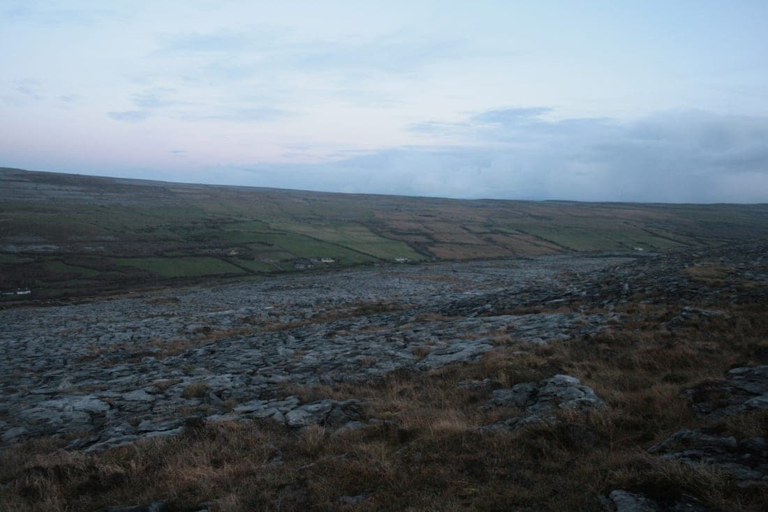
Limestone pavement is made of flat blocks (clints) separated by deep cracks (grikes), some wide enough to trap a leg. Keep dogs on a short lead, let them pick their own way at walking pace and don't let them jump from block to block. The rock is abrasive and sharp in places, so check paws at every stop. On the Mullaghmore routes, consider dog boots for dogs with soft pads, and be honest about whether your dogs are fit enough for a long day on rock.

Limestone Pavements on The Burren
Limestone Pavements on The BurrenFoto: Barry Hunter, CC BY-SA 2.0, vía Wikimedia Commons

Water is scarce

Rain disappears straight through the limestone into caves underground, so there are very few streams on the hills. Carry all the water you and your dogs need, and more on warm days, as the bare rock reflects heat and there's almost no shade.

Ticks and livestock

The park warns walkers about ticks in the grassland and scrub. Wearing light-coloured clothing makes them easier to spot, and the park suggests checking your clothes every three to four hours. Check your dogs after the walk too. The Burren uplands are also grazed by cattle, especially in winter, so keep leads short around animals and close any gates you open.

Lough Gealain, Gortlecka
Lough Gealain, GortleckaFoto: N Scott, CC BY-SA 2.0, vía Wikimedia Commons

Photographing the Burren

The Burren is a gift for photographers. Low, raking light early or late in the day brings out the texture of the pavement and the folded layers of rock on Mullaghmore. Lough Gealáin, below the hill, gives you reflections on still days. Get down low and use a crack in the pavement as a line leading into the frame, and in May and June look for spring gentians and orchids growing in the grikes. Don't pick them, and keep dogs from trampling them.

Respect the place

Burren National Park is a protected landscape. Stay on the waymarked trails, don't move or stack stones, and leave the walls and plants as you found them. Check the park's website and any notices at the trailheads before you set off, as conditions and access can change.

The Burren National Park Mullaghmore
The Burren National Park MullaghmoreFoto: The Banner, CC BY-SA 3.0, vía Wikimedia Commons

Burren through the year

Burren averages 17 rainy days in Oct and highs of about 14°C. The driest month is usually Apr.

010208°9°10°12°15°17°18°18°16°14°10°9°JanFebMarAprMayJunJulAugSepOctNovDec

Days with 1 mm of rain or moreAverage high (°C)

Show the numbers
MonthRainy daysRainAverage highSunshineSunset
Jan17117 mm8°C3.6 h/day16:47
Feb18122 mm9°C4.7 h/day17:45
Mar17126 mm10°C6.2 h/day18:38
Apr1468 mm12°C8.5 h/day20:33
May1481 mm15°C9.9 h/day21:25
Jun1584 mm17°C9.7 h/day22:03
Jul17114 mm18°C8.8 h/day21:56
Aug20136 mm18°C8.5 h/day21:06
Sep16109 mm16°C6.8 h/day19:55
Oct17120 mm14°C5.3 h/day18:43
Nov17125 mm10°C3.8 h/day16:43
Dec19147 mm9°C3 h/day16:19
Averages for 2015–2024 from Open-Meteo historical weather (CC BY 4.0); sun times calculated for the 15th of each month, local time.